Showing posts with label fort. Show all posts

Saturday, September 13, 2014

Koraigad - Lohagad Trek contd...


In the previous post, I narrated about the first part of trek namely the Koraigad fort. Here we continue on the 2nd part.

From Mumbai, there are several ways to Lohagad. If you want a more complete trek, take exit at Khalapur toll-naka and head towards Malawali station. From here you can also visit Bhaje caves. The route from here is long and it will take about an hour to just reach the base.

Since we were already in Lonavala, the shorter route was an internal road that we could drive directly till the base.

The internal road from Lonavala to Lohagad isn't that great as of now with big potholes (see map at the end of this page). Other than that the final 3 kms are a challenge for small cars with gravel littered roads giving little traction over the steep slope.
At one point, after several to and fro runs to climb uphill, the one way to give the 1L WagonR support was the age-old method of S.T. drivers; use stones on the back tyres for support. Worked like a charm and the car climbed uphill easily.

So take care at this part, don't stop for snacks here just go ahead. This is the point where the road bifurcates towards Pawna dam


Koraigad and Lohagad Forts: A Refreshing Monsoon Trek


Both these are pretty simple to do considering there are restored steps to climb them. I had already done both of them once, but Koraigad earlier was in winter.

Vashi >> Lonavala >> Peth-Shahpur(near Amby Valley) >> Koraigad >> Lohagad base village >> Lohagad >> Sinhagad Institute >> Vashi

06.00: Vashi
07.30: Lion Point
08.00: Peth-Shahpur village
09.30: Koraigad Fort
10.30: Start descent
11.15: Proceed to Lohagad
12.45: Lohagad base village
13.45: Lohagad Fort
14.30: Start descent
15.00: Lohagad base village
17.00: Vashi

Lion's Point

Reaching here at about 7.00, this place is continuous under cloud cover as this is the start of Sahyadris range with Konkan region below. Clouds coming from Arabian sea constantly ensure a foggy atmosphere.

Road visibility is next to nothing so not easy to drive this stretch as seen from the snaps below. Parking lights are a must:


Saturday, December 14, 2013

Karnala Fort Trek Through Bird Sanctuary


Karnala bird sanctuary is a small forest in Raigad district of Maharashtra.

The fort lies within the bird sanctuary perimeter. Its a thickly forested hilly region. The Karnala fort pinnacle can never be missed from Mumbai-Goa highway due to it's peculiar Thumbs-Up structure. The following image would make it clear:


Route:
Panvel -> Karnala Bird Sanctuary = 12 KM

Saturday, June 9, 2012

Unexplored Murud: Khoda Beach & Jetty


Khoda is a small village between Murud-Janjira and Rajpur. To reach proceed on the way to Janjira fort, and just as you cross the bridge you will come to a village. Take a left or ask someone for directions to the jetty and you'll reach there. The beach/jetty overlooks the Janjira fort too.

Tuesday, December 27, 2011

Anjanvel - Fish, Fort, Sea and Lighthouse


Anjanvel village is under 20 kms from Guhagar. It's also near from Dabhol village; infact midway between the two.

Anjanvel is a sleepy village but it does have some great beauty. There are no options to live or dine here; so you can explore this place while using Guhagar as a base. Reasons to visit this place:
1. Gopalgad Fort
2. Spectacular views of the sea (with lots of fishes jumping around).
3. Tolkeshwar Lighthouse.
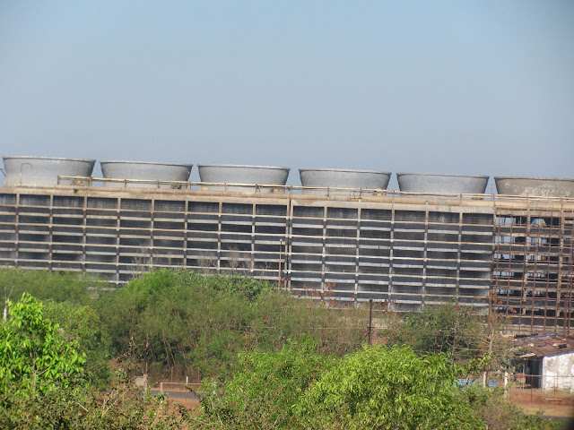
4. Dabhol Power Plant (formerly Enron).


Dabhol Power Plant

From Guhagar, head towards Dabhol and mid-way there will be a diversion towards Anjanvel village in the west (near power plant).

Strange thing is that the power plant is very near to Anjanvel rather than Dabhol and it should have been named after this village.


Sunday, December 25, 2011

Around Dapoli – Murud & Ladghar beaches


The Travel

Dapoli is a town in Ratnagiri district. It is somewhat of a hill station as it is some height above sea-level. It is not exactly at the sea but very close to a number of beaches within 10-15 kms.

Following is the route undertaken from Vashi. Significant towns are mentioned:
Vashi -> Mangaon -> Lonere Fata -> Goregaon -> Ambet -> Mandangad -> Kherdi -> Dapoli

The drive after Lonere Fata is great. The views are scenic, there are hardly any other vehicles around and the only points of congestion are through some large villages. Much of the path is through twists and turns of hills, but the roads are good and you are usually the only person driving around.


Stay at Aryawarta

As far as location and connectivity is concerned this is a great place to live. It is nearby to the Dapoli S.T. Depot.
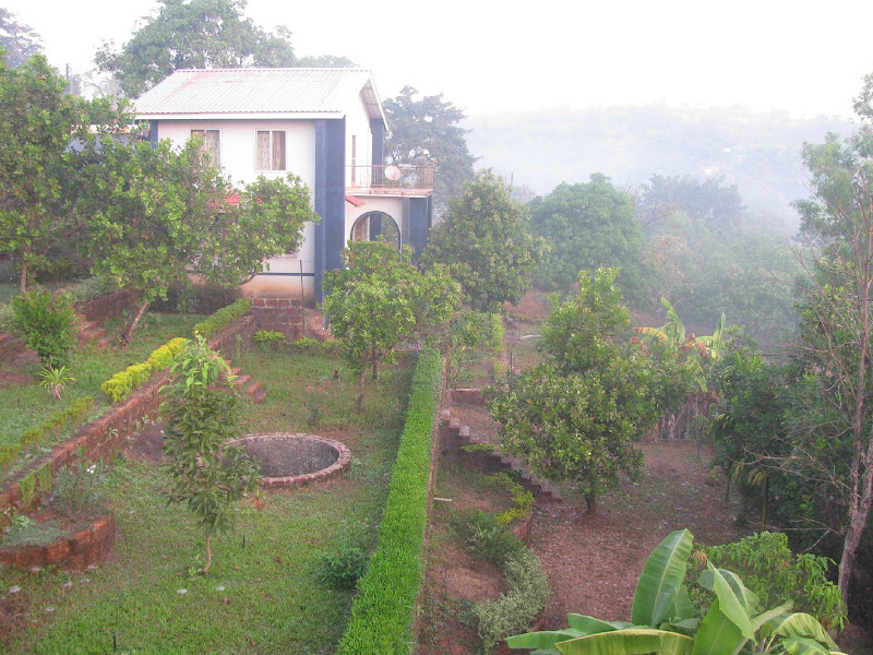
Situated on a hill, you get to have your own spacious bungalows with huge gardens around it.


Sunday, September 4, 2011

The Lone Fort in Navi Mumbai: Belapur Fort/ Shehbaz Killa


Finally, after planning for months of visiting this place; in-spite of being the closest fort to my home; the visit materialized one rainy September weekend.

The major reason for wanting to go to this place was because it was built by the Siddi's, some distant relative. So I set out with my cousin on a drive to the fort.

Sunday, October 24, 2010

Castella de Aguada/ Bandra Fort


One of the many forts in Mumbai, this one is located at the mouth of the Mithi river. Bandra fort along with the Mahim fort at the other side of river, once stood as strategic positions for the Portuguese.
Exact location is next to Taj Land's End.


I set out one Sunday morning just after sunrise with my cousin Nazeef to have a look. Photos are not that clear since they are from a cellphone.
The fort area is divided into 2 parts - the fort ruins and a garden.


I. Fort Area:


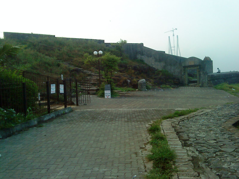
Not much of the fort remains. There is hardly any structure remaining; just an entrance, some walls and staircase.


Entire view of fort with the sea link in the background:


Saturday, August 7, 2010

Kothligad Fort Trek


Also known as Kothaligad/ Peth fort. First a brief description.
Base Town: Karjat (well conected by rail/ road)
Base Village: Ambivali (150 metres)
Height: 620 metres
Difficulty level: Moderate (but somewhat dangerous in monsoon)
Time: 1 day trek (Although we took 3.5 hours for ascent and 3 hours for descent for various reason;  I think it can be accomplished totally in 5 hours)
Food: At Ambivali you can get food at Sawant's house (the first house when you take turn to get into the village). At Peth, Sawant's brother does the food arrangement. 
Accommodation: There is accomdoation available in Peth village.


Route: Vashi --> Panvel --> Karjat --> Ambivali --> Peth --> Kothaligad

  1. Vashi --> Karjat was covered by State Transport bus. (about 2 hours)
  2. Karjat --> Ambivali village, we hired a 6 seater (or TumTum as i colloquially used). Note that it is important to hire for entire day......as there is no means of transport available from Ambivali. He took Rs. 900 for dropping us at Ambivali and then taking us back to Karjat. (Time: 1 hour)
  3. Ambivali --> Peth village is a hilly ascent; although long but is made easy bcoz of the stony path that has been laid for the villagers. (2 hours)
  4. From Peth, the steep ascent begins to the mount of Kothaligad. (1.5 hours)

Saturday, January 2, 2010

Koraigad/ Korigad Fort Trek


Beginning the new year with a trek, how good is that !!!

How to get there?


Mumbai --> Lonavala --> Bushi Dam --> INS Shivaji --> Peth Shahpur village(2-4 kms before Amby Valley).

Once you are in Lonavala ask for the direction of Amby Valley since that village is very small and not famous. It is around 25 kms from Lonavala.


The total trek distance is quite small and you can cover it in an hour.


Best time to visit is winter. In summer, the heat will become unbearable since you have nearly a 2.5 km trail to cover on the top of fort without a single tree or any other shade. In rains, I think you will not be able to see anything at all from the top.

Caution: Depths in the photograph are greater than what they appear.
I still don't understand why hardly any of the photographs from the 4 digicams, reflect the true depths as we saw. Almost 90% of the pix have misleading depths.


The Village Trail

The trail begins near a school in the village. This part is stony and dusty and without much forest cover.


Friday, May 1, 2009

Kashid saved the day


You can call it a day - When almost everything went wrong. We had a four day long weekend and I had suggested we goto Murud. The original plan was to visit Murud fort and beach in a 1 day trip. But all planning went haywire.
As per plan:
06.45: Vashi
10.15: Murud (11.00 at the worst case)
Had we been on track, things would have been fine.


Chronology of Travel
07.30: Vashi ( Full 45 mins delay)


08.00: Beyond Panvel. Stopped for breakfast


08:40: Restarted journey. This long break was going to cost dearly.
09.30: Reached Pen. Even with the A.C., the heat was becoming unbearable.
10.15: Reached Alibaug. By this time everyone in the backseat was thoroughly "basking" in the sun.
Rev Danda: The fortified town: remains of the walls

Sea near Rev Danda:

Sea near Chaul village with Chaul fort of the hill


10.50: Stopped at Petrol Pump. Took 20 mins. break here.


12.15: Finally at Rajpuri village, near Murud fort. (Nearly 2 hours behind schedule.)
14.00: Back to Murud for lunch.
15.00: On Murud beach.
15.15: Off from Murud.
15.45: At Kashid beach.
18.30: Off from Kashid.
21.30: Dining at Belapur.
22.00: Reached Vashi.

Doordarshan of Murud fort


The Murud fort rests in the Arabian sea; hence you require a ferry from Rajpur village to reach the same. On Fridays, the ferry service is closed between 12.00 - 14.00 due to prayers. Effectively it means you can only see the fort if you come before 11.00 or after 15.00.
There are no facilities for eating; the lone hotel out there is extremely poor in service. We wasted 1 hour for food; but the huge surge in visitors coupled with shortage of manpower ensured that we stayed hungry.
So, we dropped the plan for fort and returned back to Murud for food. Whatever we saw of the fort was from the Rajpur wharf and jetty.


Rajpur beach:


Rajpur village:


Food, Food, Food....
The 3 hour break in ferry service matched by the spate of tourists ensured that all luncheon options in Murud were packed way beyond capacity.
This guaranteed that we would not get to eat food for atleast 1 hour. The hunger would surely become unbearable by then. The only option - roadside fastfood.
Zankhana, Swati and me were contended with Omlette-Pav. Others with Vada Pav, Juices, Milkshakes and Baraf-golas.

Tanmay in deep thought:


Short stint at Murud beach

Thanks to the hordes of tourists, oil exploration by Reliance and zero maintainence by municipality, the beach is going the Alibaug way. The sand has mostly turned blackish with traces of oil. This has also led to change in the sea water colour. And all this when Reliance is only "exploring" - searching for oil. If they really start extracting, I doubt any beaches in Konkan will survive.
Abbas of beach with the Kasa fort to his right:

Deciding on going to Kashid:

Designs in the sand:

Dead Octopus, I think


Kashid beach - the day saviour
By now, most were turned off by the events of the day. No fort no beach.....hence decided on Kashid.


We reached Kashid @ 15.45. By 16.00, me and Swati were already in the sea. The rest (except Zank), trickled one by one. Zank didn't have spare clothing like Amit; so she didn't venture out. Amit came out anyways.
Kashid beach has mostly white sand; which shows it is largely made up of a crushed powder of sea shells. The sand grains are thick; thus the beach is somewhat young.
The unique thing that I experienced at this beach was the pull that the receding waves exerted; trying to drag you in the sea. The source of the pull is largely the 35 degrees inclination of the beach towards the sea.


We enjoyed a lot in the sea with Husain and me dragging everyone else inside. I think it was only we too, who submerged many a times entirely in the water primarily due to laying in the water.
Swati, Gayatri, Pritisha and Abbas did not venture out too ahead. Amit and Tanmay where somewhat ahead inside.
Zank was lazing on the beach bed all alone. I think the travel, the heat and the food had turned her off the most. Had to bring her to the sea. Although she barely came inside the water, she was the only one who clicked. Thanks to her we had photographs of Kashid.


Engravings in the sand:


Before departing from Kashid.....jst didn't feel like returning


Sunday, January 4, 2009

Sudhagad Trek

Type of Location: Hill Fort
Fort Condition: Dilapidated
Height: 590 metres
Nearest Town: Pali (10km from Nagothane)
Travel Time: 2.5 hours from Panvel


Base pointsPachhapurDhondse
Distance from Pali: 13km 12km
Difficulty Level: Easy Somewhat Difficult
Trek Time: 2 hours 3 hours
Route: Stairway Forests and Rocks
Suitable For: Monsoon Trek Adventure
Tips:
  1. Carry water with you. Water is available at the top but not potable.
  2. There is an partially open structure that can be used to rest and if you plan to stay overnight (about 75 people). However it won't help in monsoon.
  3. There is a temple that can accomodate about 20 people for staying.
  4. Dhondse route is difficult and quite tiring. Trek only in winter and carry lots of liquids (juices, milkshakes, glucose).
  5. It is much more convenient to have your own vehicle. It isn't much costly to hire one either. Better not depend on public transport

Our Adventure (3rd Jan 2009):

Our trek was quite exhaustive and tiring (and maybe even frustrating for some). But, I think if we would not have travelled through the route, our trek would not have been so enjoyable.

We started on our trek at 10.45am (Ya, I know that's pretty late, but there were lots of issues that led to this) from Dhondse village (We were scheduled to go through the easier route of
Pachhapur, but lost our way. And this was not the last time we were going to lose our way.).

Next we crossed the waterless Datpadi riverbed (and deviated from the straight path to lose our way again.), passed through small uncultivated fields.


Not finding any proper path to reach the top, we had to move up a small hill with moderate amount of vegetation. Although this was enjoyable little did we know that this was going to be the trailer before the big picture.

We started ascending though smoothened large rocks (looked like volcanic in origin).

We found a trail and assumed it to be the route to Sudhagad.
Next was a decidious forests (I assume it to be decidious because this was the winter season and most tress had shed their leaves) for about 200-250 metres.


Further ahead was a grassy field for about 200 metres.

Uptill this point the sun shone brightly on our heads and was tiring us. It was about 11.45 am by now.

After this, the real adventure began. We entered an Evergreen forest. The forest was quite cool and the lack of direct sunlight was most welcome.


We continued following the trail through the forests.
The trail was broken at various points due to the now empty waterfalls.

And suprisingly there was absolutely no wildlife spotted. Forget about mammals, we couldn't even see any birds or insects.

Similarly, there was only one variety of some lavender coloured flower throughout the way.

Travelling through the forest was perhaps the best part of the trek. (I meant the forest only, not the rock climbing part).

At about 12.30, the ascent begins:


How much more to go ???

breaks like these were common (infact every 5 mins)


False Victory # 1: When we looked at these first man-made structures; we thought we were near.


We found a new model


and 2 master photographer's. Thanks to Swati and Dileena for clicking pictures of everything that was possible to click.


and 3 Smith's agents' (straight out of Matrix)

False Victory # 2: A small entrance and some steps.


The best photograph (bcoz Swati not there)


The best photograph (with Swati. I have no idea what my hands are potraying. Blame it on short-term memory loss.)
Note: Short-term Memory Loss - Due to the physical fatigue, hardly anyone could remember what they had seen a few minutes ago

The Hill next-door


False Victory # 3: Fort Walls and Mahadarwaza


No idea what dance the two guys in the background are doing.


Finally on the top. Around 2.15 pm. We took around 3.5 hours for the climb.


Views from the top


The place where we rested. (can also be used for overnight stay)


A flavour-some tea break (I meant the flavour of the water used in making tea).


4pm: Going back. Initially, it was a breeze while descending; but a little later we had gone crazy of stones.


There was scarcity of water because the water at the top wasn't exactly potable.
Not many photos were clicked on the return journey as all photographers had lost all interest in it.

All everyone wanted to do was drink.

Please leave your comments below.