Sunday, February 22, 2015

Beaches along Shriwardhan coast


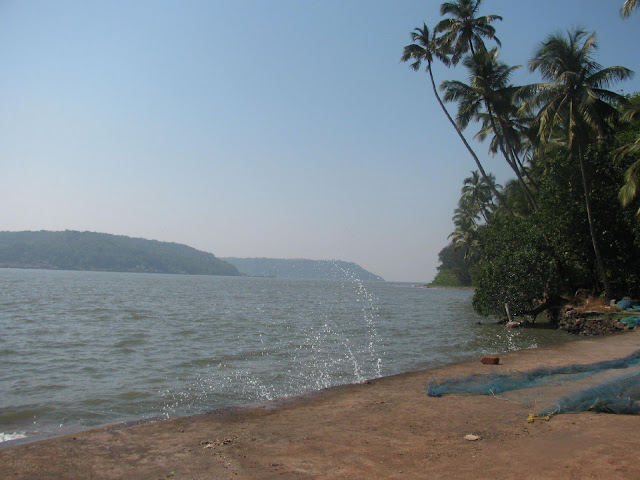
The Shriwardhan taluka of Raigad district is entirely located along the Arabian Sea coastline beginning from Dighi village in the north to Harihareshwar village in the south. Until quite recently barring Diveagar and Harihareshwar, the beaches were unknown to tourist (even those too were famous only because of historic temples). Although the beaches are still good, but they could soon become non-visit material due to port activities and tourist commercialization.

Despite a major part of the coastline being rocky or cliff filled, there are several sandy seashores. Am listing down the places I visited although there are quite a few more (Dighi, Sarve, Velas & Harihareshwar were skipped).


Adgaon Beach


Tuesday, October 7, 2014

Tungarli Lake / Dam in Lonavala


Tungarli Lake

Lonavala has tons of lakes and ponds; some natural ones and several ones created due to the innumerable dams built in this area. One such lake known as Tungarli lake is formed by a small dam. Calling this a lake would be geographically incorrect usage of the term "lake". At best it can be said to be a pond since it's size seems to be quite small even though the rainy season was just ending. I doubt the water will exist even beyond winter.

It's about 4 kms from Lonavala. The approach road is a narrow one and uphill enough. It's probably tarred because some resort have opened here near the lake. While on the road you will encounter the dam wall. Its quite old and was probably built during the British era.

Once near the lake there is plenty of evidence of human litter, some eatable bags and plates; plastics and all but this was still minimal. The main problem is innumerable glass shards of broken bottles all obviously alcoholic. I think going in the lake barefoot will surely leave you bruised in several places. In case you plan to spend the time here, search for a place not littered with glass for your safety. Better still clean the place for yourself. I think the other bank of the lake could be much more cleaner than this place since this is the first point of contact.
Inspite of all this the place is still not that dirty, still visitable.

Monday, October 6, 2014

Karala Caves: The 350 Steps Climb


A few kms from Lonavala off the old Mumbai-Pune highway lie the twin caves of Karla and Bhaje. When you notice the road sign of Karala, take a turn in opposite direction since the road-sign is actually for the village and the caves lie on the other side.

There is now a road that takes you very close to the caves and the climb is reduced considerably (just 100). However, horsepower issues ensured that we climbed the whole way by parking at the foothills.

Initially the steps are large (I mean large in length) and about a metre or two. Then they start reducing gradually and towards the end become normal sized.


Saturday, September 13, 2014

Koraigad - Lohagad Trek contd...


In the previous post, I narrated about the first part of trek namely the Koraigad fort. Here we continue on the 2nd part.

From Mumbai, there are several ways to Lohagad. If you want a more complete trek, take exit at Khalapur toll-naka and head towards Malawali station. From here you can also visit Bhaje caves. The route from here is long and it will take about an hour to just reach the base.

Since we were already in Lonavala, the shorter route was an internal road that we could drive directly till the base.

The internal road from Lonavala to Lohagad isn't that great as of now with big potholes (see map at the end of this page). Other than that the final 3 kms are a challenge for small cars with gravel littered roads giving little traction over the steep slope.
At one point, after several to and fro runs to climb uphill, the one way to give the 1L WagonR support was the age-old method of S.T. drivers; use stones on the back tyres for support. Worked like a charm and the car climbed uphill easily.

So take care at this part, don't stop for snacks here just go ahead. This is the point where the road bifurcates towards Pawna dam


Koraigad and Lohagad Forts: A Refreshing Monsoon Trek


Both these are pretty simple to do considering there are restored steps to climb them. I had already done both of them once, but Koraigad earlier was in winter.

Vashi >> Lonavala >> Peth-Shahpur(near Amby Valley) >> Koraigad >> Lohagad base village >> Lohagad >> Sinhagad Institute >> Vashi

06.00: Vashi
07.30: Lion Point
08.00: Peth-Shahpur village
09.30: Koraigad Fort
10.30: Start descent
11.15: Proceed to Lohagad
12.45: Lohagad base village
13.45: Lohagad Fort
14.30: Start descent
15.00: Lohagad base village
17.00: Vashi

Lion's Point

Reaching here at about 7.00, this place is continuous under cloud cover as this is the start of Sahyadris range with Konkan region below. Clouds coming from Arabian sea constantly ensure a foggy atmosphere.

Road visibility is next to nothing so not easy to drive this stretch as seen from the snaps below. Parking lights are a must:


Saturday, December 14, 2013

Karnala Fort Trek Through Bird Sanctuary


Karnala bird sanctuary is a small forest in Raigad district of Maharashtra.

The fort lies within the bird sanctuary perimeter. Its a thickly forested hilly region. The Karnala fort pinnacle can never be missed from Mumbai-Goa highway due to it's peculiar Thumbs-Up structure. The following image would make it clear:


Route:
Panvel -> Karnala Bird Sanctuary = 12 KM

Thursday, October 17, 2013

Lonavala: Pavana Dam Boating Trip


Pavana/ Pawana Dam is about 45 mins drive from Lonavala. Since we were already based in Lonavala it served as an ideal place to spend time.
The drive as expected is entirely through hilly narrow one lane roads, so just be careful. Nevertheless the scenery is quite picturesque green especially since we were going at end of monsoon.

The main attraction here is the boating in the lake. View from the parking lot:


There's a garden near the boating club. It also houses a cafeteria which was a relief considering the hot sun.

Wednesday, October 16, 2013

Valley's With A Name: Khandala's Tiger and Lonavala's Lion


Tiger Valley

Located in Khandala in the beginning as soon as you cross over the ghat; has magnificent views of the valley. Almost anyone travelling to Pune will never have missed it. Although seen several times over, never really had stopped to see it. It's best observed from Old Mumbai-Pune highway since that is at a greater height.
A couple of scenes from the valley:

Saturday, June 9, 2012

Unexplored Murud: Khoda Beach & Jetty


Khoda is a small village between Murud-Janjira and Rajpur. To reach proceed on the way to Janjira fort, and just as you cross the bridge you will come to a village. Take a left or ask someone for directions to the jetty and you'll reach there. The beach/jetty overlooks the Janjira fort too.

Tuesday, December 27, 2011

Anjanvel - Fish, Fort, Sea and Lighthouse


Anjanvel village is under 20 kms from Guhagar. It's also near from Dabhol village; infact midway between the two.

Anjanvel is a sleepy village but it does have some great beauty. There are no options to live or dine here; so you can explore this place while using Guhagar as a base. Reasons to visit this place:
1. Gopalgad Fort
2. Spectacular views of the sea (with lots of fishes jumping around).
3. Tolkeshwar Lighthouse.
4. Dabhol Power Plant (formerly Enron).


Dabhol Power Plant

From Guhagar, head towards Dabhol and mid-way there will be a diversion towards Anjanvel village in the west (near power plant).

Strange thing is that the power plant is very near to Anjanvel rather than Dabhol and it should have been named after this village.


Monday, December 26, 2011

Guhagar Beach, Ratnagiri


After our stay in Dapoli, we moved towards Guhagar using the ferry service at Dabhol. This ferry saves you almost 50 km road and since it carries vehicles too, there can be nothing better than that.

Guahagar is a beach facing small town, very little commercialized and even in this peak season had only a few tourists.

We reached the place in afternoon and had no bookings done for stay; praying that we get some place to stay.
Maybe because it was a Monday, we got two dormitories in an managed MTDC house named Kinara. The cost is a pretty decent one of Rs 200 per head for stay. Good that we could explore our options for food on our own.

Fields behind our Hotel:


Dabhol - Shahi Masjid and Ferry to Guhagar


From Dapoli, we started towards Guhagar. The road distance is about 100 km. However, there is a ferry service connecting Dabhol and Dhopve villages over the Dabhol creek which cuts the distance by half.

The ferry service is not just for carrying people but it carries vehicles too. The charges are Rs. 10 per head and Rs. 50 per car/ SUV.

Although it did not save much time as we had a 45 minutes waiting time for the ferry, I think it gives a good break from the road driving and breaks the monotonousness.


During the waiting time, I wandered around the village and stumbled upon this historical masjid.

Sunday, December 25, 2011

Around Dapoli – Murud & Ladghar beaches


The Travel

Dapoli is a town in Ratnagiri district. It is somewhat of a hill station as it is some height above sea-level. It is not exactly at the sea but very close to a number of beaches within 10-15 kms.

Following is the route undertaken from Vashi. Significant towns are mentioned:
Vashi -> Mangaon -> Lonere Fata -> Goregaon -> Ambet -> Mandangad -> Kherdi -> Dapoli

The drive after Lonere Fata is great. The views are scenic, there are hardly any other vehicles around and the only points of congestion are through some large villages. Much of the path is through twists and turns of hills, but the roads are good and you are usually the only person driving around.


Stay at Aryawarta

As far as location and connectivity is concerned this is a great place to live. It is nearby to the Dapoli S.T. Depot.
Situated on a hill, you get to have your own spacious bungalows with huge gardens around it.


Sunday, September 4, 2011

The Lone Fort in Navi Mumbai: Belapur Fort/ Shehbaz Killa


Finally, after planning for months of visiting this place; in-spite of being the closest fort to my home; the visit materialized one rainy September weekend.

The major reason for wanting to go to this place was because it was built by the Siddi's, some distant relative. So I set out with my cousin on a drive to the fort.

Saturday, April 23, 2011

Unexplored Murud: The Khokri Tombs


About 6 kms. from Murud-Janjira (and 1.5 kms. from Rajpuri) lies the Khokri (a.k.a Khokari) Tombs. They are just a km ahead from Rajpuri jetty where people board boats going to Janjira fort.

You will need to have your own vehicle to reach that place. Although you may get some local transport; you could struggle for the return journey since that place is secluded with no settlements nearby. Expect this to change after the construction of the Dighi-Agardanda port.

The tombs are of the earliest Siddis (probably the black African descendants). There are 3 major tombs  - One large and two smaller ones.


Unexplored Murud: Northern Part of Murud Beach


It's close to impossible that anyone who has been to Murud has missed it's beach. The Beach is about 2-3 kms in length flanked by cliffs with the Nawab's  Palace to the north and the Ekdaria river to the south.

However, most of the people visit the southern and central part of the beach; while ignoring th north. The main reason is because most places of stay and eateries are located there.
Good for me, I usually find this stretch to be empty even if its some holiday weekend.
I went to this beach just about at sunrise time. Sunrise is delayed thanks to the presence of a couple of hills in the east.

Photobucket

Friday, April 22, 2011

Unexplored Murud: The Nawab Siddi's Palace


On Friday I got an opportunity to explore the restricted palace from somewhat close distance thanks to the fact that the Nawab is some long-distance relative and Friday prayers are held in the Masjid inside.

I didn't explore the palace from inside and I think I made a big mistake of not seeking permission from the Nawab and losing this golden opportunity.

Anyways whatever I have explored is as follows:


The Masjid

The Masjid was earlier not used, but now the Nawab has opened it up for public. Many people come here for Friday prayers now.
There is one large tomb, next to the Masjid with some more graves behind. Probably this was the private graveyard of the Siddis.

Sunday, October 24, 2010

Castella de Aguada/ Bandra Fort


One of the many forts in Mumbai, this one is located at the mouth of the Mithi river. Bandra fort along with the Mahim fort at the other side of river, once stood as strategic positions for the Portuguese.
Exact location is next to Taj Land's End.


I set out one Sunday morning just after sunrise with my cousin Nazeef to have a look. Photos are not that clear since they are from a cellphone.
The fort area is divided into 2 parts - the fort ruins and a garden.


I. Fort Area:


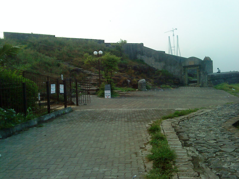
Not much of the fort remains. There is hardly any structure remaining; just an entrance, some walls and staircase.


Entire view of fort with the sea link in the background:


Saturday, August 7, 2010

Kothligad Fort Trek


Also known as Kothaligad/ Peth fort. First a brief description.
Base Town: Karjat (well conected by rail/ road)
Base Village: Ambivali (150 metres)
Height: 620 metres
Difficulty level: Moderate (but somewhat dangerous in monsoon)
Time: 1 day trek (Although we took 3.5 hours for ascent and 3 hours for descent for various reason;  I think it can be accomplished totally in 5 hours)
Food: At Ambivali you can get food at Sawant's house (the first house when you take turn to get into the village). At Peth, Sawant's brother does the food arrangement. 
Accommodation: There is accomdoation available in Peth village.


Route: Vashi --> Panvel --> Karjat --> Ambivali --> Peth --> Kothaligad

  1. Vashi --> Karjat was covered by State Transport bus. (about 2 hours)
  2. Karjat --> Ambivali village, we hired a 6 seater (or TumTum as i colloquially used). Note that it is important to hire for entire day......as there is no means of transport available from Ambivali. He took Rs. 900 for dropping us at Ambivali and then taking us back to Karjat. (Time: 1 hour)
  3. Ambivali --> Peth village is a hilly ascent; although long but is made easy bcoz of the stony path that has been laid for the villagers. (2 hours)
  4. From Peth, the steep ascent begins to the mount of Kothaligad. (1.5 hours)

Sunday, February 28, 2010

Panchgani Trek - Day 2


Packing up

I woke up at around 07.00 am. Sunrise had happened but the sun had not risen thanks to the surrounding mountains.


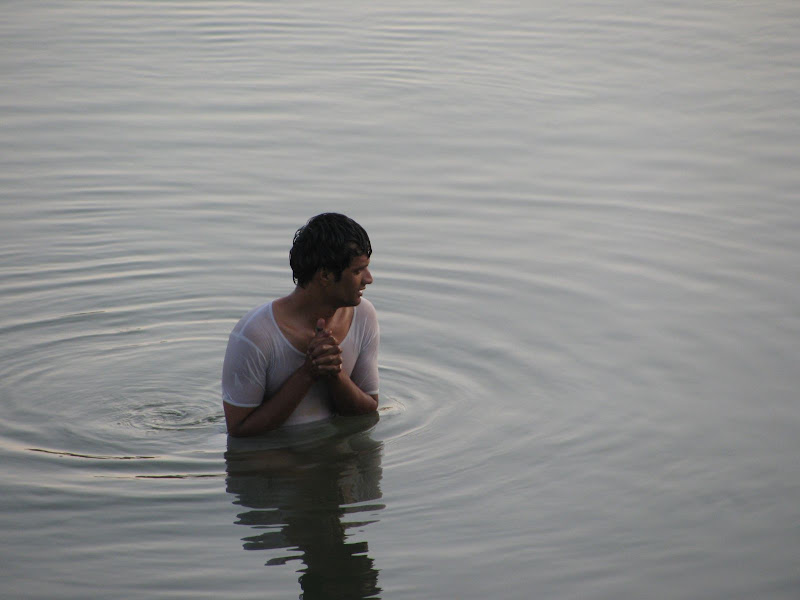
Since the water wasn't so cleaned and had large amount of silts; none had ventured into it. But in the morning Ismail couldn't resist and took a holy dip in the river Krishna.